
Downloads
DOI:
https://doi.org/10.7480/rius.2.212Published
Issue
Section
License
Copyright (c) 2011 Arnoud de Boer, Leen Breure, Sandor Spruit, Hans Voorbij

This work is licensed under a Creative Commons Attribution 4.0 International License.
How to Cite
Abstract
Using 3D computer graphics technology, we are able to create virtual reconstructions of (almost completely) disappeared landscapes. The applications of these virtual historic landscapes range from landscape archaeology, edutainment to landscape planning. Although computer graphics technology matured and photo-realistic representations are achieved, the creation of realistic virtual reconstructions remains problematic. For a realistic user experience, we need to know which cues influence the user perception. However, poor-defined visualization requirements for 3D virtual historic landscapes leave us with the question ‘How good is good enough?’
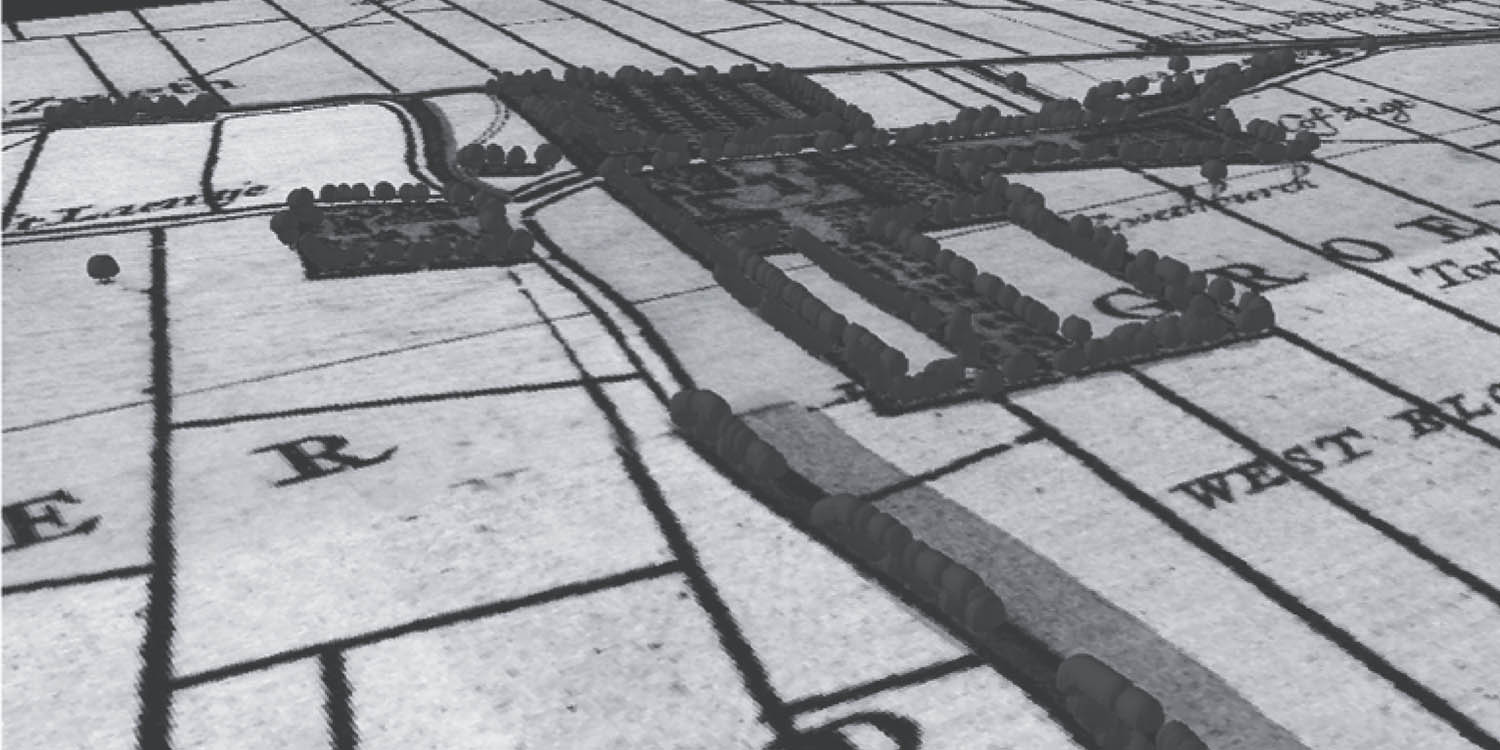
This article discusses the search for a decisive variable to let users perceive the virtual historic landscape, focusing on image quality and contents of the virtual historic landscape. The virtual reconstruction of Palace Honselaarsdijck, a 17th century real-estate of stadtholder Frederick Henry (1584-1647), and its surrounding landscape is used as a case study. Using old maps, image processing and GIS software the historic terrain model was generated. By application of a 3D historic object library, the virtual landscape was decorated with wind mills, houses, churches and so forth. Finally, the virtual historic landscape was completed with atmospheres, water and vegetation. The result is a full-decorated and rendered virtual historic landscape. From a preliminary user test, the researchers learned that the contents of the virtual historic landscape are more important than the image quality. Future work will focus on what the identifying landscape features for a realistic user experience are, and how to communicate uncertainty inside the virtual landscape. The expectation is that the work contributes to the realization of virtual historic landscape on a large-scale to communicate landscape information to the broad public.
References
Alkhoven, P. (1993) The changing image of the city: a study of the transformation of the townscape using computer-aided architectural design and visualization techniques: a case study: Heusden. Utrecht, Utrecht University.
Appleton, K., and Lovett, A. (2005) GIS-based visualisation of development proposals - reactions from planning and related professionals. Computers, Environment and Urban Systems 29; 321- 339
Bakker, B. (2004) Landschap en wereldbeeld: van Van Eyck tot Rembrandt. Bussum, Thoth.
Beekhuizen, M. (2008) Met andere ogen. Tour for the former real estate Honselaarsdijck.
Bishop, I. D., and Lange, E. (2005) Communication, Perception and Visualization. In: Bishop, I.D., and Lange, E. (eds.), Visualization in Landscape and Environmental Planning: Technology and Applications. London, Taylor & Francis, pp 2-19
Bishop, I. D. (1994) The Role of Visual Realism in Communicating and Understanding Spatial Change and Process. In: Unwin, D.J., and Hearnshaw, H.M. (eds.), Visualization in Geographic Information Systems. London, John Wiley, pp 60-64
Blakemore M. and Harley J.B. (1980) The Search for Accuracy. Concepts in the History of Cartography. Cartographica Monograph 26; 55
Blijdenstijn, R., and Stenvert, R. (2000) Bouwstijlen in Nederland (1040-1940). Nijmegen, SUN.
Buijsen, E. (1993) Between Fantasy and Reality: 17th Century Dutch Landscape Painting. Baarn, De Prom.
De Boer, A., and Voorbij, J.B. (2010) Visualisatie van temporele aspecten in 3D virtuele historische landschappen. In: Bakker, N., Breure, L., and Quak, W. (eds.), Geo-informatie kent geen tijd? Delft, NGC, pp 29-34
De Boer, A. (2010) Processing old maps and drawings to create virtual historic landscapes. e-Perimetron 5 (2); 49-57
De Boer, A., Voorbij, J.B., and Breure, L. (2009) Towards a 3D Visualization Interface for Cultural Landscapes and Heritage Information. In: Online Proceedings of the 37th International Conference on Computer Applications and Quantitative Methods in Archaeology (CAA).
De Boo, M. (2001) Een nieuw zicht op Delft: Delftse geodeten en industrieel ontwerpers tonen 3D-perspectief ontleend aan 17e eeuwse prenten. Delft, Delft Integraal.
Drettakis, G., Roussou, M., Reche, A., and Tsingos N. (2007) Design and Evaluation of a Real-World Virtual Environment for Architecture and Urban Planning. Presence 16; 318-332
Dylla, K., Frischer, B., Mueller, P., Ulmer, A., and Haegler, S. (2010) Rome Reborn 2.0: A Case Study of Virtual City Reconstruction Using Procedural Modeling Techniques. In: CAA 2009. Making History Interactive. Oxford, Archaeopress, pp 62-66
Erfgoedhuis ZH (2011) http://www.geschiedenisvanzuidholland.nl/ [accessed: 22 February 2011]
Ervin, S.M., and Hasbrouck, H.H. (2001) Landscape Modelling: Digital Techniques for Landscape Visualization. New York, McGraw-Hill.
Ervin, S.M. (2001) Digital landscape modeling and visualization: a research agenda. Landscape and Urban Planning 54 (1-4); 49-62
Huijts, C.S.T.J. (1984) De ontwikkeling van de Middendelflandse boerderij; een onderzoek in het kader van de reconstructie van Midden-Delfland. Vlaardingen, Midden-Delfland Vereniging.
Jenny, B. (2010) New features in MapAnalyst. e-Perimetron 5 (3); 176-180
Lasseter, J. (1987) Principles of Traditional Animation Applied to 3D Computer Animation. Computer Graphics 21(4); 35-44
Laycock, R.G., and Drinkwater, D. (2008) Exploring Cultural Heritage Sites through Space and Time. Journal on Computing and Cultural Heritage 1; 1-23
Maes, B. (2006) Inheemse bomen en struiken in Nederland en Vlaanderen: Herkenning, verspreiding, geschiedenis en gebruik. Amsterdam, Boom.
Meischke, R. (1993) Huizen in Nederland : architectuurhistorische verkenningen aan de hand van het bezit van de Vereniging Hendrick de Keyser. Zwolle, Waanders.
Morren, Th. (1909) Het Huis Honselaarsdijk. Leiden, vereeniging "Die Haghe".
Paar, P. (2006) Landscape Visualizations: Applications and Requirements of 3D Visualization Software for Environmental Planning. Computers, Environment and Urban Systems 30; 815-839
Perkins, N. (1992). Three questions on the use of photo-realistic simulations as real world surrogates. Landscape and Urban Planning 21; 265–267
Postma, C. (1977) Kruikius. Kaart van Delfland, 1712. Alphen aan den Rijn, Canaletto.
Renes, H. (2010) Op zoek naar de geschiedenis van het landschap : handleiding voor onderzoek naar onze historische omgeving. Hilversum, Verloren.
Roussou, M., and Drettakis, G. (2003) Photorealism and Non-photorealism in Virtual Heritage Representation. In: Arnold, D.B., Chalmers, A., and Niccolicci F. (eds.) Proceedings of the International Symposium on Virtual Reality, Archaeology, and Intelligent Cultural Heritage (VAST'03). Switzerland, Eurographics Association, pp 51-60
University of Virginia (2010) Rome Reborn. http://www.romereborn.virginia.edu/ [accessed: 1 November 2010]
Zuk, T., Carpendale, S., and Glanzman, W.D. (2005) Visualizing Temporal Uncertainty in 3D Virtual Reconstructions. In: Mudge, M., Ryan, N., and Scopigno, R. (eds.), Proceedings of the 6th International Symposium on Virtual Reality, Archaeology and Cultural Heritage (VAST’05). Italy, Eurographics Association, pp 99-106