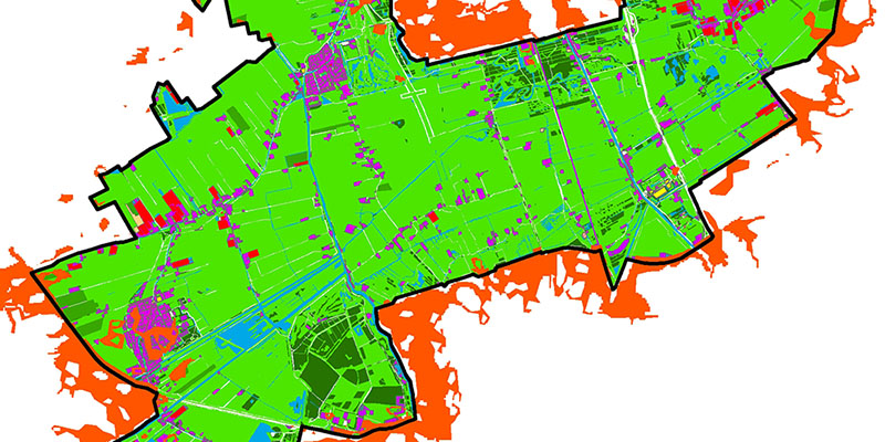
The case study of South Holland

Downloads
DOI:
https://doi.org/10.7480/rius.4.904Published
Issue
Section
License
Copyright (c) 2016 Leyre Echevarria Icaza, Andy Van Den Dobbelsteen, Frank van der Hoeven

This work is licensed under a Creative Commons Attribution 4.0 International License.
How to Cite
Abstract
The purpose of this research is to analyse the thermal behaviour of South Holland provincial parks during heat waves, in order to provide design adaptation guidelines to increase their cooling capacity over the hotspots present in their urban surroundings. This research analyses the thermal behaviour of different land use patches (forests, cropland, grassland, water surfaces, built areas and greenhouse areas) present in the six South Holland provincial parks during heat waves. It studies their average night land surface temperature (LST) (with Modis 11A1), day LST (with Landsat 5TM), NDVI, imperviousness, patch size and patch shape index, and analyses through a multiple regression analysis the impact of each of these last four parameters in the night and day LST for each land use. Within each land use category, NDVI, imperviousness and patch shape index influence differently the thermal behaviour of the patches. NDVI is inversely correlated to day LST for all categories, imperviousness is correlated to day LST for all areas which do not comprise a significant presence of greenhouses (grassland and built patches) and inversely correlated to LST for areas with a high presence of greenhouses (cropland and warehouses). Finally the shape index varies depending on the nature of the surrounding patches, especially for small patches (built areas, forests and greenhouse areas). Most of the hotspots surrounding the Midden-Delfland park are adjacent to grassland patches. The measure to increase the cooling capacity of those patches would consist in a change of land use and or an increase of the NDVI of the existing grassland patches. These suggestions to increase the cooling potential of the parks remain deliberately open in order to allow combining these measures with other spatial planning priorities.
References
Burghardt R., Katzschner L., Kupski S., Chao R. and Spit T.(2010). Urban Climatic Map of Arnhem City. Future Cities, urban networks to face climate change. Interreg IV. (www.future-cities.eu)
Brücker G. (2005) Vulnerable populations: lessons learnt from the summer 2003 heat waves in Europe. Euro Surveillance, 10(147).
Cao X., Onishi A., Chen J., and Imura H. (2010). ‘Quantifying the cool island intensity of urban parks using ASTER and IKONOS data’. Landscape and urban planning.
Centraal Bureau voor de Statistiek (2006).
http://www.cbs.nl/nr/exeres/CA1F091F-F641-47E6-AB18-D517143A609D.htm
Chang C.R., Li M.H. and Chang S.D. (2007). A preliminary study on the local cool-island intensity of Taipei city parks. Landscape and Urban Planning 80, 386–95.
Cheng X., Wei B., Chen G., Li J., and Song C. (2014). ‘Influence of Park Size and Its Surrounding Urban Landscape Patterns on the Park Cooling Effect.’ Journal Urban Planning Development.
Choi H., Lee W., Byun W. (2012). Determining the Effect of Green Spaces on Urban Heat Distribution Using Satellite Imagery. Asian Journal of Atmospheric Environment Vol. 6-2, 127-135.
City of Freiburg. http://planning.cityenergy.org.za/index.php/world-cities/europe/city-of-freiburg-germany.
City of Stuttgart, Office for Environmental Protection, Section of Urban Climatology. Climate Atlas of the Region of Stuttgart (2008). http://www.stadtklimastuttgart.de/index.php?climate_climate_atlas_2008
Coll C., Galve J. M., Sánchez J. M., and Caselles V. (2010). Validation of Landsat-7/ETM+ Thermal-Band Calibration and Atmospheric Correction With Ground-Based Measurements. IEEE Trans. Geosci. Remote Sens. vol. 48.1. 547–555.
Davoudi S., Crawford J., and Mehmood A. (2010). Planning for climate change: Strategies for mitigation and adaptation for spatial planners. Earthscan, London.
Dousset B., Gourmelon F., Laaidi K., Zeghnoun A., Giraudet E., Bretin P., Mauri E. and Vandentorren S. (2011). Satellite monitoring of summer heat waves in the Paris metropolitan area. International Journal of Climatology 31. 313-323.
Eusuf M.A. and Asaeda T. (1996) Heating effects of pavement on urban thermal environment. Journal of Civil Engineering. The Institution of Engineers, Bangaldesh. 26.2.
Feyisa G.L., Dons K., Meilby H. (2014) Efficiency of parks in mitigating urban heat island effect: An example from Addis Ababa. Landscape and Urban Planning. Volume 123, March 2014, Pages 87–95.
Freiburg. Sustainable Urban Development Policy and the Land Use Plan 2020. http://planning.cityenergy.org.za/index.php/world-cities/europe/city-of-freiburg-germany).
Gallo K. P., McNab A. L., Karl T. R., Brown J. F., Hood J. J., and Tarpley J. D.(1993). The use of NOAA AVHRR data for assessment of the urban heat island effect. Journal of Applied Meteorology 32.5. 899-908.
Garssen J, Harmsen C, de Beer J. (2005). The effect of the summer 2003 heat wave on mortality in the Netherlands. Euro Surveillance 10. 165–168.
Gill S. E., Handley J. F., Ennos A. R. and Pauleit S. (2007). ‘Adapting Cities for Climate Change: The Role of the Green Infrastructure’, Built Environment, (33) 115–133.
Hebbert M, Webb B. (2011). Towards a Liveable Urban Climate:Lessons from Stuttgart. Liveable Cities: Urbanising World, Wuhan, China, ISOCARP. Knowledge for better Cities.
Hoyois P., Scheuren J-M, Below R., Guha-Sapir D. (2007). Annual Disaster Statistical Review: numbers and trends 2006. Université Catholique de Louvain. CRED. Centre for research on the epidemiology of disasters.
Jauregui E. (1975). Microclima del bosque de chapultepec, Bulletin No.6, Instituto de Geografia, University of Mexico (in Spanish).
Jauregui E. (1990–1991). Influence of a large urban park on temperature and convective precipitation in a tropical city. Energy Build. 15(16) 457–463.
Kadaster NL (2013) TOP 10 NL (https://www.kadaster.nl/web/artikel/productartikel/TOP10NL.htm)
KNMI (Koninklijk Nederlands Meteorologisch Instituut). (2013).http://www.knmi.nl/cms/content/28253/hittegolf
http://www.knmi.nl/klimatologie/lijsten/hittegolven.html
Meehl G.A. and Tebaldi C. (2004) More intense, more frequent and longer lasting heat waves in the 21st century. Science 13. 305/5686.994-997.
Li J., Song C., Cao L., Zhu F., Meng X., Wu J. (2011) Impacts of landscape structure on surface urban heat islands: A case study of Shanghai, China. Remote Sensing of Environment. 115.12.p3249-3263.
Oke T. R.(1987). Boundary layer climates, 2nd ed., Methuen, London, New York.
Parlow E. (1998). Net radiation of urban areas. Proc. 17th EARSeL Symposium on Future Trends in Remote Sensing, Lyngby, Denmark, 17-19 June 1997.221-226. Balkema, Rotterdam.
Parlow E. (2003). The Urban Heat Budget Derived from Satellite Data. Geographica Helvetica Jg. 58.
Patton, D.R., 1975. A diversity index for quantifying habitat “edge”. Wildl. Soc. Bull. 3, 171–173.
Potchter O., Cohen P. and Bitan A. (2006). Climatic behaviour of various urban parks during hot and humid summer in the Mediterranean city of Tel Aviv, Israel. International Journal of Climatology 26,1695–711.
Rosenzweig C., Solecki W. D., Hammer S.A., Mehrotra S. (2011). Climate Change and Cities (First Assessment Report of the Urban Climate Change Research Network). United States of America by Cambridge University Press, New York, Cambridge University Press.
Regionaal Strategische Agenda Stadsregio Rotterdam: http://stadsregio.nl/sites/stadsregio.nl/files/files/Regionaal%20Strategische%20Agenda(1).pdf.
Richter R., Schlapfer D. (2013) Atmospheric/Topographic Correction for Satellite Imagery. ATCOR-2/3 User Guide, Version 8.2.1.
Robine J., Cheung S., Leroy S., Vanoyen H., Griffiths C., Michel J. and Herrmann F. (2008,). Death toll exceeded 70,000 in Europe during the summer of 2003. Comptes Rendus Biologies, 331(2) 171–178.
Ruimtelijk Plan Regio Rotterdam 2020: http://stadsregio.nl/ruimtelijke-ontwikkeling.
Saaroni H.and Ziv B. (2003). The impact of a small lake on heat stress in a Mediterranean urban park: the case of Tel Aviv, Israel. International Journal of Biometeorology. 47(3): 156-165.
Sardon J.P. (2007).The 2003 heat wave. Euro Surveillance, 12(3) 226.
Shaviv E., Yezioro A., Capeluto I.G. (2001). Sun and winds in a new business district in Tel Aviv. Seventh International IBPSA Conference. Río de Janeiro. Brazil.
Spronken-Smith R.A. (1994). Energetics and cooling in urban parks. Unpublished Ph.D. Thesis. The University of British Columbia.
Spronken-Smith R. A., Oke T. R. (1998). The thermal regime of urban parks in two cities with different summer climates. International journal of remote sensing, 19(11). 2085-2104.
Steeneveld G.J., Koopmans S., Heusinkveld B.G., Van Hove L.W.A., Holtslag A.A.M. (2011) Quantifying urban heat island effects and human comfort for cities of variable size and urban morphology in the Netherlands.
Stovin V. R., Jorgensen A., and Clayden A. (2008). Street trees and storm water management. Arboricultural Journal, 30(4), 297-310.
Structuurvisie Zuid-Holland:
Taha H., Akbari H., Rosenfeld A. (1991) Heat island and pasis effects of vegetative canopies: Micrometeorological field-measurements. Theoretical and Applied Climatology.44.2.p123-138.
Upmanis H., Eliasson I., Lindqvist S. (1998). The influence of green areas on nocturnal temperatures in a high latitude city (Goteborg, Sweden). International Journal of Climatology 18: 681-700.
US Geological Survey (USGS) webpage, Earth Resources Observation and Science Center (EROS). http://glovis.usgs.gov/
Von Stulpnagel A, Horbert M, Sukkop H. (1990). The importance of vegetation for the urban climate. Urban Ecology, SPB Academic Publishing, The Hague. 175-193.
Van Hove L.W.A., Steeneveld G.J., Jacobs C.M.J., Heusinkveld B.G., Elbers J.A., Moors E.J., Holtslag A.A.M. (2011). Exploring the Urban Heat Island Intensity of Dutch Cities. (Assessment based on literature review, recent meteorological observations and datasets provided by hobby meteorologists). Altera report 2170. Wageningen.
Voogt J. . Urban plume. (http://www.actionbioscience.org/environment/voogt.html)
Yu C. and Hien, W.N. (2006). Thermal benefits of city parks. Energy and Buildings 38, 105–20.
Zhou W., Huang G., Cadenasso M. (2011). Does spatial configuration matter? Understanding the effects of land cover pattern on land surface temperature in urban landscapes. Landscape and Urban Planning. Vol 102, Issue 1, 30 July 2011 p. 54-63.