A profiling approach
Downloads
DOI:
https://doi.org/10.7480/rius.4.824Abstract
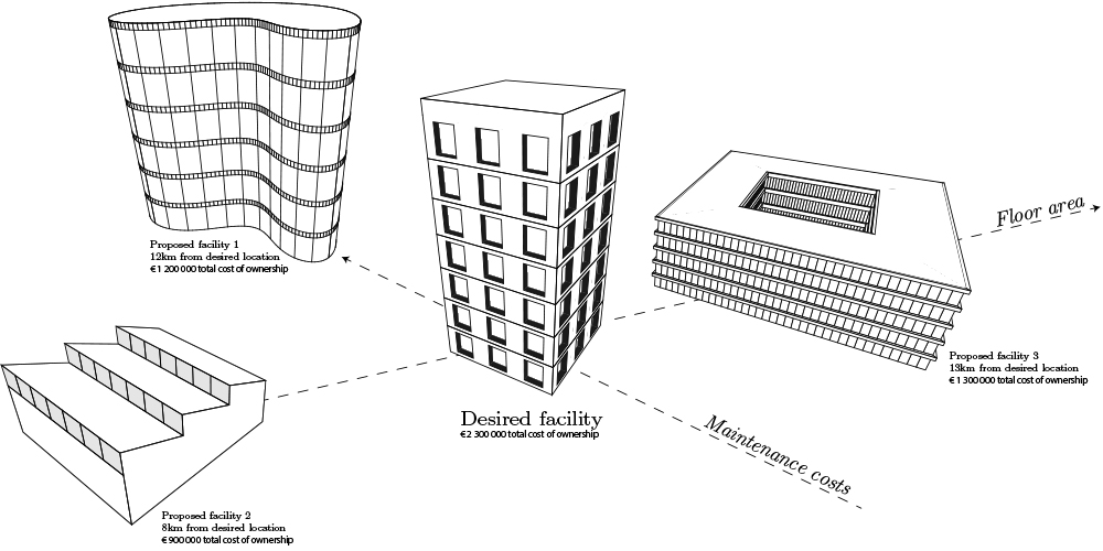
Lingering vacant facilities deteriorate the condition of an urban environment, and, as a consequence, actuate neighboring companies to leave the area as well. In addition, new development efforts keep depleting scarce land resources. In this paper, a framework is presented to match existing vacant facilities to the requirements of potential customers or owners to promote sustainable redevelopment and reuse. Important attributes for facility reuse are identified from literature. To automatically extract these attributes from models and their surroundings, Geospatial information and Building Information Models (BIM) are combined. In the proposed framework, a profile is created for each existing vacant facility by combining BIM and GIS attributes. As a result, these profiles can be matched to the desired BIM model, which the aspiring users have provided, based on a weighted distance calculation. The framework presents the most suitable vacant facilities to the users in order to promote facility reuse. These facility reuse alternatives are evaluated based on a single monetary metric that represents the effort required to partially or fully accommodate the requirements of the aspiring users, which is reflected in the weighted distance between profiles from existing vacant facilities and the facility desired by the end-user. This framework identifies suitable areas for redevelopment after which a process is started that forms an iterative and comprehensive evaluation dialog between demand and supply parties, on multiple scale levels, including various design alternatives to adapt the existing facility to the desires of the consumer and revitalize the surroundings according to Geodesign principles. A proof-of-concept of the framework is presented together with the conceptual system structure. Evaluation of the attributes and the technical implementation of their extraction from BIM and GIS data show the technical feasibility of the approach.
How to Cite
Published
Issue
Section
License
Copyright (c) 2016 Tong Wang, Thomas Krijnen, Bauke de Vries

This work is licensed under a Creative Commons Attribution 4.0 International License.
References
Abudeif, A. M., Abdel Moneim, A. A., & Farrag, A. F. (2015). Multicriteria decision analysis based on analytic hierarchy process in GIS environment for siting nuclear power plant in Egypt. Annals of Nuclear Energy, 75, 682-692. doi:10.1016/j.anucene.2014.09.024
Beg, I., & Ashraf, S. (2009). Similarity measures for fuzzy sets. Applied Mathematics and Computation, 8(2), 192-202.
Blokhuis, E. (2010). Governing Multi-Actor Decision Processes in Dutch Industrial Area Redevelopment. Eindhoven University of Technology.
Bottom, C., McGreal, S., & Heaney, G. (1998). The suitability of premises for business use: an evaluation of supply/demand variations. Property Management, 16, 134-144. doi:10.1108/02637479810232934
Chaudhuri, B. B., & Rosenfeld, A. (1996). On a metric distance between fuzzy sets. Pattern Recognition Letters, 17, 1157-1160.
Das, J., Leng, L. E., Lee, P., & Kiat, T. C. (Eds.). (2011). The BIM Issue. Building Smart.
De Laat, R., & Van Berlo, L. (2011). Integration of BIM and GIS: The Development of the CityGML GeoBIM Extension. In T. H. Kolbe, G. König, & C. Nagel (Eds.), Advances in 3D Geo-Information Sciences SE - 13 (pp. 211-225). Springer Berlin Heidelberg. doi:10.1007/978-3-642-12670-3_13
EI-Mekawy, M., Ostman, A., & Hijazi, I. (2012). An Evaluation of IFC-CityGML Unidirectional Conversion. International Journal of Advanced Computer Science and Applications, 3(5), 159-171.
Geraedts, R. P., & Van der Voordt, D. J. M. (2003). Offices for living in: An instrument for measuring the potential for transforming offi ces into homes. Open House International, 28(3), 80-90.
Glumac, B. (2012). Strategic Decision Modeling in Brownfield Redevelopment. Eindhoven University of Technology.
Isikdag, U., & Zlatanova, S. (2009). Towards Defining a Framework for Automatic Generation of Buildings in CityGML Using Building Information Models. In J. Lee & S. Zlatanova (Eds.), 3D Geo-Information Sciences SE - 6 (pp. 79-96). Springer Berlin Heidelberg. doi:10.1007/978-3-540-87395-2_6
Korteweg, P. J. (2002). Veroudering van kantoorgebouwen: probleem of uitdaging? Nederlandse Geo-grafische Studies
McElvaney, S. (2012). Geodesign: Case Studies in Regional and Urban Planning. ESRI.
Mignard, C., & Nicolle, C. (2014). Computers in Industry Merging BIM and GIS using ontologies application to urban facility management in ACTIVe3D. Computers in Industry, 65(9), 1276-1290. doi:10.1016/j.compind.2014.07.008
Ministerie van Infrastructuur en Milieu (Ministry of Infrastructure and Environment) (2013). Ibis werklo-caties de stand van zaken in planning en uitgifte van werklocaties op 1 jan. 2013 en de uitgifte in 2012.
Montes, S. (2007). Distance between fuzzy sets as a fuzzy quantity. Mathematics, 14, 41-49.
Nagel, C., Stadler, A., & Kolbe, T. (2007). Conversion of IFC to CityGML. Paris.
Panichelli, L., & Gnansounou, E. (2008). GIS-based approach for defining bioenergy facilities location: A case study in Northern Spain based on marginal delivery costs and resources competition between facilities. Biomass and Bioenergy, 32(4), 289-300. doi:10.1016/j.biombioe.2007.10.008
Remøy, H. T. (2010). Out of office. A Study on the Cause of Office Vacancy and Transformation as a Means to Cope and Prevent. IOS Press.
Rich, S., & Davis, K. H. (2010). Geographic Information Systems (GIS) for Facility Management. Solutions, 55. Retrieved from http://www.ifmafoundation.org/documents/public/GIS_WP_FINAL.pdf
Rikalovic, A., Cosic, I., & Lazarevic, D. (2014). GIS Based Multi-criteria Analysis for Industrial Site Selection. Procedia Engineering, 69, 1054-1063. doi:10.1016/j.proeng.2014.03.090
Shen, W., Hao, Q., & Xue, Y. (2012). A loosely coupled system integration approach for decision support in facility management and maintenance. Automation in Construction, 25, 41-48. doi:10.1016/j.aut-con.2012.04.003
Shipley, R., Utz, S., & Parsons, M. (2006). Does Adaptive Reuse Pay? A Study of the Business of Building Renovation in Ontario, Canada. International Journal of Heritage Studies, 12(6), 505-520. doi:10.1080/13527250600940181
Steinitz, C. (2012). A Framework for Geodesign: Changing Geography by Design. ESRI.Stichting Real Estate Norm Nederland (1992). Real Estate Norm.
Van der Voordt, D. J. M. & Van Wegen, H. B. (2005). Architecture In Use: An Introduction to the Program-ming, Design and Evaluation of Buildings. Routledge.
Volk, R., Stengel, J., & Schultmann, F. (2014) Building Information Modeling (BIM) for existing buildings. Literature review and future needs. Automation in construction, 38, 109-127.
Zeiss, G. (2014). Bridging Demand-Supply Gap. Amsterdam.
Zhang, F., Johnson, D. M., & Sutherland, J. W. (2011). A GIS-based method for identifying the optimal location for a facility to convert forest biomass to biofuel. Biomass and Bioenergy, 35(9), 3951-3961. doi:10.1016/j.biombioe.2011.06.006


